
The Corinth Canal has a very long and interesting history, going all the way back to the time of Roman Emperor Nero. Emperor Nero actually began digging in the very spot where the canal is today. There is even a memorial to the Roman workers who tried to establish a canal across the Isthmus of Corinth.
The canal is about 70 feet wide at sea level. It gets wider at the top due to the angled sides. The sides are 300 feet high all across the length of the canal. Even so, only ships that are less than 60 feet wide are able to transit the canal. That leaves out many larger ships and cruise ships.
The canal cuts off the Peloponnese peninsula from the Greek mainland, making it into an island. To get across, there are train, car, and highway bridges.

A satellite map reveals the location and length of the Corinth Canal.
The canal didn’t really have much of a chance to be built until more modern machinery could be employed. Still, many men were employed to do construction work, along with barges, cranes, and earth moving equipment. Construction began in earnest in 1881, and was completed and opened for traffic in 1893.

Looking west towards the Gulf of Corinth.
Being only 70 feet wide, the canal will accommodate only smaller ships. Even so, the canal handles over 10,000 ships a year. Most of them are small cruise ships and some tourist ships that can transit the canal effectively.

Looking east to the Saronic Gulf in the Aegean Sea.

The canal is small compared to other canals that are more modern. As ships get ever larger, fewer vessels are able to take advantage of this strategic short cut.
The ships that do navigate the canal face strong winds and currents that make the transit a bit hazardous. Plus there is the problem of rocks falling and possible landslides. Stabilizing the walls of the canal has been necessary several times.
During World War II, the Germans used explosives to cause damage to the canal and put it out of commission. The canal was strategically important, As the Germans retreated from Greece, they damaged the canal and made it impassable.
Later, the U.S. Army Corps of Engineers cleared the canal in 1948 for use again.
A quick stop to look at the Corinth Canal is a brief respite from the drive to the Peloponnese. A chance to see a real piece of history, and to have a meal before pressing on. There is much to see in the Peloponnese.
What To See & Do:
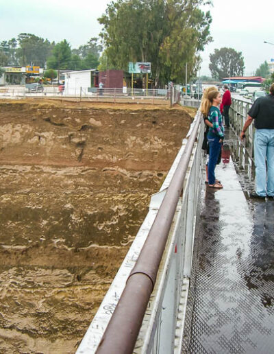
When driving across the Corinth bridge, you can stop at the nearby restaurant and park in their lot. Walk to the pedestrian part of the bridge and stop in the middle to get some very interesting pictures.
Where To Eat:
You can stop at the restaurant on the north side of the bridge. Just follow the signs. After eating, make your way over to the bridge to get some pictures and to think about the great history of the area.
Where To Stay:
Check VRBO for apartment and vacation rentals. CLICK HERE to view available apartments and rental rates in Corinth, Greece. Or check for other locations. People drive to the Peloponnesian Peninsula from Athens and other cities.

Steven Ward founded 10 Minute Travel in 2006. He wanted to create a website that would focus on interesting sights and attractions. The website has seen several changes over the years. Steve is a retired Coast Guard Officer who has worked in the IT field after leaving the service. He has been all over Alaska on ships, sailed through the Panama Canal, stopped in Jamaica and Aruba, and gone on a handful of trips to Europe and Asia. Taiwan, Japan, and Thailand were some of the more recent trips overseas. If there is a vaccine for the travel bug, he will refuse it. 🙂